Tree line
The tree line is the edge of the habitat at which trees are capable of growing. Beyond the tree line, they are unable to grow because of inappropriate environmental conditions (usually cold temperatures, insufficient air pressure, or lack of moisture). Some distinguish additionally a deeper timberline, where trees can develop trunks.
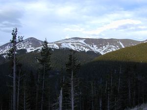
At the tree line, tree growth is often very stunted, with the last trees forming low, densely matted bushes. If it is caused by wind, it is known as krummholz formation, from the German for 'twisted wood'.
The tree line, like many other natural lines (lake boundaries, for example), appears well-defined from a distance, but upon sufficiently close inspection, it is a gradual transition in most places. Trees grow shorter towards the inhospitable climate until they simply stop growing.
Contents |
Types
There are several types of tree lines defined in ecology and geology:
- Alpine tree line
- The highest elevation that sustains trees; higher up, it is too cold or snow cover persists for too much of the year, to sustain trees. Usually associated with mountains, the climate above the tree line is called an alpine climate, and the terrain can be described as alpine tundra. Mountains of the Pacific Northwest of North America exhibit lower treelines on north-facing slopes than south-facing slopes, because increased shade means the deep snowpack takes longer to melt, which shortens the growing season for trees.
- Desert tree line
- The driest places that trees can grow; drier desert areas having insufficient rainfall to sustain trees. These tend to be called the "lower" tree line and occur below about 5000 ft (1500 m) elevation in the Desert Southwestern United States. The desert treeline tends to be higher on pole-facing slopes than equator-facing slopes, because the increased shade on a pole-facing slope keeps those slopes cooler and prevents moisture from evaporating as quickly, giving trees a longer growing season and more access to water.
- Desert-Alpine tree line
- In some mountainous areas, higher elevations above the condensation line or on equator-facing and leeward slopes can result in low rainfall and increased exposure to solar radiation. This dries out the soil, resulting in a localized arid environment unsuitable for trees. The slopes of Mauna Loa above 10,000 ft in Hawaii are an example of this. Many south-facing ridges of the mountains of the Western U.S. have a lower treeline than the northern faces because of increased sun exposure and aridity.
- Double tree line
- Different tree species have different tolerances to drought and cold. Mountain ranges isolated by oceans or deserts may have restricted reportoires of tree species with gaps that are above the alpine tree line for some species yet below the desert tree line for others. For example several mountain ranges in the Great Basin of North America have lower belts of Pinyon Pines and Junipers separated by intermediate brushy but treeless zones from upper belts of Limber and Bristlecone Pines.
- Exposure tree line
- On coasts and isolated mountains the tree line is often much lower than in corresponding altitudes inland and in larger, more complex mountain systems, because strong winds reduce tree growth. In addition the lack of suitable soil, such as along talus slopes or exposed rock formations, prevents trees from gaining an adequate foothold and exposes them to drought and sun.
- Arctic tree line
- The northernmost latitude in the Northern Hemisphere where trees can grow; farther north, it is too cold to sustain trees. Extremely cold temperatures can result in freezing of the internal sap of trees, killing them. In addition, permafrost in the soil can prevent trees from getting their roots deep enough for the necessary structural support.
- Antarctic tree line
- The southernmost latitude in the Southern Hemisphere where trees can grow; further south, it is too cold to sustain trees. It is a theoretical concept that does not have any defined location. No trees grow in Antarctica or the sub-antarctic islands. This tree line would be the southernmost point in the environment at which trees can no longer grow, except there are no landmasses that have a true treeline analogous to the arctic treeline.
- Other tree lines
- The immediate environment is too extreme for trees to grow. This can be caused by geothermal exposure associated with hot springs or volcanoes, such as at Yellowstone, high soil acidity near bogs, high salinity associated with playas or salt lakes, or ground that is saturated with groundwater that excludes oxygen from the soil, which most tree roots need for growth. The margins of muskegs and bogs are common examples of these types of open areas. However, no such line exists for swamps, where trees, such as Bald cypress and the many mangrove species, have adapted to growing in permanently waterlogged soil. In some colder parts of the world there are tree lines around swamps, where there are no local tree species that can develop. There are also man-made pollution tree lines in weather exposed areas, where new tree lines have developed because of the increased stress of pollution. Example are around Nikel in Russia and previously in the Erzgebirge.
Typical vegetation

Some typical Arctic and alpine tree line tree species (note the predominance of conifers):
Eurasia
- Dahurian Larch (Larix gmelinii)
- Macedonian Pine (Pinus peuce)
- Swiss Pine (Pinus cembra)
- Mountain Pine (Pinus mugo)
- Arctic White Birch (Betula pubescens subsp. tortuosa)
North America
- Subalpine fir (Abies lasiocarpa)
- Subalpine Larch (Larix lyallii)
- Engelmann Spruce (Picea engelmannii)
- Whitebark Pine (Pinus albicaulis)
- Great Basin Bristlecone Pine (Pinus longaeva)
- Rocky Mountains Bristlecone Pine (Pinus aristata)
- Foxtail Pine (Pinus balfouriana)
- Limber Pine (Pinus flexilis)
- Potosi Pinyon (Pinus culminicola)
- Black spruce (Picea mariana)
- Hartweg's Pine (Pinus hartwegii)
South America
- Antarctic Beech (Nothofagus antarctica)
- Lenga Beech (Nothofagus pumilio)
- Polylepis (Polylepis tarapacana)
Australia
- Snow Gum (Eucalyptus pauciflora)
Worldwide distribution
Alpine tree lines
The alpine tree line at a location is dependent on local variables, such as aspect of slope, rain shadow and proximity to either geographical pole. In addition, in some tropical or island localities, the lack of biogeographical access to species that have evolved in a sub-alpine environment, can result in lower tree lines than one might expect by climate alone.
Given this caveat, here is a list of approximate tree lines from locations around the globe:
| Location | Approx. latitude | Approx. elevation of tree line | Notes | |
|---|---|---|---|---|
| (m) | (ft) | |||
| Scotland | 57°N | 500 | 1,600 | [1] |
| Sweden | 68°N | 800 | 2,600 | |
| Chugach Mountains, Alaska | 61°N | 700 | 2,300 | Tree line around 1500 feet or lower in coastal areas |
| Norway | 61°N | 1,100 | 3,600 | Much lower near the coast, down to 5-600 metres. At 71°N, in Finnmark county, the tree-line is below sea level (Arctic tree line). |
| Olympic Mountains WA, USA | 47°N | 1,500 | 4,900 | Heavy winter snowpack buries young trees until late summer |
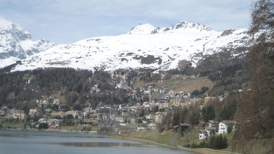
| Swiss Alps | 47°N | 2,200 | 7,200 | [2] |
| Canadian Rockies | 51°N | 2,400 | 7,900 | |
| Mount Katahdin, Maine, USA | 46°N | 1,150 | 3,770 | |
| Eastern Alps, Austria, Italy | 46°N | 1,750 | 5,740 | more exposure to Russian cold winds than Western Alps |
| Alps of Piedmont, Northwestern Italy | 45°N | 2,100 | 6,900 | |
| New Hampshire, USA | 44°N | 1,400 | 4,600 | Some peaks have even lower treelines because of fire and subsequent loss of soil, such as Grand Monadnock and Mount Chocorua. |
| Wyoming, USA | 43°N | 3,000 | 9,800 | |
| Rila and Pirin Mountains, Bulgaria | 42°N | 2,300 | 7,500 | Up to 2600m on favorable locations. Mountain Pine is the most common tree line species. |
| Pyrenees Spain, France, Andorra | 42°N | 2,300 | 7,500 | Mountain Pine is the tree line species |
| Wasatch Mountains, Utah, USA | 40°N | 2,900 | 9,500 | Higher (nearly 11,000 feet) in the Uintas |
| Rocky Mountain NP, USA | 40°N | 3,500 | 11,500 | On warm southwest slopes |
| 3,250 | 10,660 | On northeast slopes | ||
| Japanese Alps | 39°N | 2,900 | 9,500 | |
| Yosemite, USA | 38°N | 3,200 | 10,500 | West side of Sierra Nevada[3] |
| 3,600 | 11,800 | East side of Sierra Nevada[3] | ||
| Sierra Nevada, Spain | 37°N | 2,400 | 7,900 | Precipitation low in summer |
| Himalaya | 28°N | 4,400 | 14,400 | |
| Hawaii, USA | 20°N | 2,800 | 9,200 | Geographic isolation and no local tree species with high tolerance to cold temperatures (see Mt. Kilimanjaro). |
| Pico de Orizaba, Mexico | 19°N | 4,000 | 13,000 | [2] |
| Costa Rica | 9.5°N | 3,400 | 11,200 | |
| Mount Kilimanjaro, Tanzania | 3°S | 3,000 | 9,800 | Example of a tropical location lacking biogeographical access to species that are evolved for living in a subalpine environment. Thus, the tolerance of the indigenous species is lower and it results in a lower tree line |
| New Guinea | 6°S | 3,900 | 12,800 | |
| Andes, Peru | 11°S | 3,900 | 12,800 | East side; on west side tree growth is restricted by dryness |
| Andes, Bolivia | 18°S | 5,200 | 17,100 | Western Cordillera; highest treeline in the world on the slopes of Sajama Volcano (Polylepis tarapacana) |
| 4,100 | 13,500 | Eastern Cordillera; treeline is lower because of lower solar radiation (more humid climate) | ||
| Sierra de Córdoba, Argentina | 31°S | 2,000 | 6,600 | Precipitation low above trade winds, also high exposure |
| Australian Alps, Australia | 36°S | 2,000 | 6,600 | West side of Australian Alps |
| 1,700 | 5,600 | East side of Australian Alps | ||
| Tasmania, Australia | 41°S | 1,200 | 3,900 | Cold Winters, Strong Cold Winds and Cool Summers with occasional summer snow restrict tree growth |
| South Island, New Zealand | 43°S | 1,200 | 3,900 | Strong maritime influence serves to cool summer and restrict tree growth |
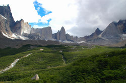
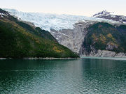
| Torres del Paine, Chile | 51°S | 950 | 3,120 | Strong influence from the Southern Patagonian Ice Field serves to cool summer and restrict tree growth[4] |
| Navarino Island, Chile | 55°S | 600 | 2,000 | Strong maritime influence serves to cool summer and restrict tree growth[4] |
Arctic tree lines
Like the alpine tree lines shown above, polar tree lines are heavily influenced by local variables such as aspect of slope and degree of shelter. In addition, permafrost has a major impact on the ability of trees to place roots into the ground. When roots are too shallow, trees are susceptible to windthrow and erosion. Trees can often grow in river valleys at latitudes where they could not grow on a more exposed site. Maritime influences such as ocean currents also play a major role in determining how far from the equator trees can grow. Here are some typical polar treelines:
| Location | Approx. longitude | Approx. latitude of tree line | Notes |
|---|---|---|---|
| Norway | 24°E | 70°N | The North Atlantic current makes Arctic climates in this region warmer than other coastal locations at comparable latitude. In particular the mild winters prevents permafrost. |
| West Siberian Plain | 75°E | 66°N | |
| Central Siberian Plateau | 102°E | 72°N | Extreme continental climate means the summer is warm enough to allow tree growth at higher latitudes, extending to northernmost forests of the world at 72°28'N at Ary-Mas (102° 15' E) in the Novaya River valley, a tributary of the Khatanga River and the more northern Lukunsky grove at 72°31'N, 105° 03' E east from Khatanga River. |
| Russian Far East (Kamchatka and Chukotka) | 160°E | 60°N | The Oyashio Current and strong winds affect summer temperatures to prevent tree growth. The Aleutian Islands are almost completely treeless. |
| Alaska | 152°W | 68°N | Trees grow north to the south facing slopes of the Brooks Range. The mountains block cold air coming off of the Arctic Ocean. |
| Northwest Territories, Canada | 132°W | 69°N | Reaches north of the Arctic Circle because of the continental nature of the climate and warmer summer temperatures. |
| Nunavut | 95°W | 61°N | Influence of the very cold Hudson Bay moves treeline southwards. |
| Quebec | 72°W | 56°N | Very strong influence of the Labrador Current on summer temperatures. In parts of Labrador, the treeline extends as far south as 53°N. |
| Greenland | 50°W | 64°N | Determined by experimental tree planting in the absence of native trees because of isolation from natural seed sources; a very few trees are surviving, but growing slowly, at Søndre Strømfjord, 67°N. |
Antarctic tree lines
Kerguelen Island, Île Saint-Paul, South Georgia, South Orkney, and other Sub-Antarctic islands are all so heavily wind exposed and with a far too cold summer climate (tundra) that none have any indigenous tree species.
Antarctic Peninsula is the northernmost point in Antarctica and has the mildest weather. It is located 1,080 kilometres (670 mi) from Cape Horn on Tierra del Fuego (Tierra del Fuego contains trees). But, no trees live on Antarctica. In fact, only a few species of grass, mosses, and lichens survive on the peninsula. In addition, no trees survive on any of the subantarctic islands near the peninsula.
See also
- Ecotone: a transition between two adjacent ecological communities
- Edge effect: the effect of contrasting environments on an ecosystem
- Massenerhebung effect
- Tundra: an area where tree growth is inhibited by low temperatures and short growing seasons
References
Footnotes
- ↑ Action For Scotland's Biodiversity (page 85)
- ↑ 2.0 2.1 Körner, Christian. "High Elevation Treeline Research". http://pages.unibas.ch/botschoen/treeline_elevation/index.shtml. Retrieved 2010-06-14.
- ↑ 3.0 3.1 Schoenherr, Allan A. (1995). A Natural History of California. UC Press. ISBN 0-520-06922-6.
- ↑ 4.0 4.1 Tree-ring growth patterns and temperature reconstruction from Nothofagus pumilio (Fagaceae) forests at the upper tree line of southern, Chilean Patagonia
Further Reading
- Arno, S. F. & Hammerly, R. P. 1984. Timberline. Mountain and Arctic Forest Frontiers. The Mountaineers, Seattle. ISBN 0-89886-085-7
- Beringer, J., Tapper, N. J., McHugh, I., Lynch, A. H., Serreze, M. C., & Slater, A. 2001. Impact of Arctic treeline on synoptic climate. Geophysical Research Letters 28 (22): 4247-4250.
- Korner, C. 1998. A re-assessment of high elevation treeline positions and their explanation. Oecologia 115:445-459.
- Ødum, S. 1979. Actual and potential tree line in the North Atlantic region, especially in Greenland and the Faroes. Holarctic Ecology 2: 222-227.
- Ødum, S. 1991. Choice of species and origins for arboriculture in Greenland and the Faroe Islands. Dansk Dendrologisk Årsskrift 9: 3-78.